Projects
Bicycling and Mobility
This page will be updated periodically with new information on bikeway infrastructure projects in the City of San Diego. We're highlighting projects in the design process, those in construction and newly opened to the public. This is not intended to be a comprehensive list.
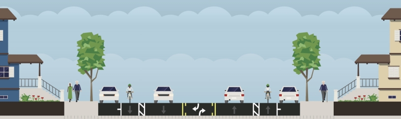
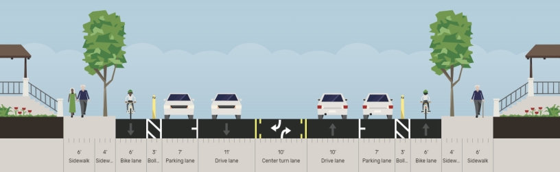
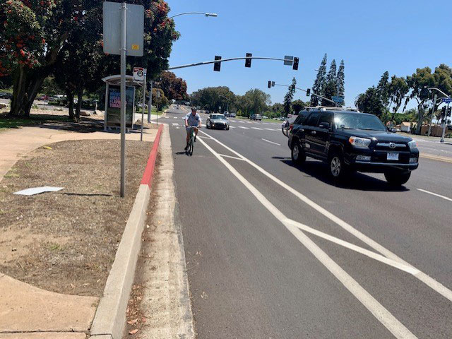
Convoy Street
From Kearny Mesa Road to SR-52
Project Status: Complete
Following the recently completed water and wastewater pipe replacement project, the City of San Diego is fully repaving Convoy Street from the State Route 52 on-ramp to Kearny Mesa Road complete with separated bike lanes that will improve mobility and safety for all modes of transportation.
Fact Sheet: ![]() Convoy Project Facts
Convoy Project Facts
Kearny Mesa Community Plan: www.sandiego.gov/planning/community-plans/kearny-mesa
Parking Study: ![]() Convoy Corridor Parking Study 2023
Convoy Corridor Parking Study 2023 ![]() Parking Study Presentation
Parking Study Presentation
Mobility Presentations:
![]() Paving, Parking and Multi-Modal Improvement Presentation
Paving, Parking and Multi-Modal Improvement Presentation
![]() Mobility and Parking Presentation
Mobility and Parking Presentation
Project Updates: Project Page and Updates
Sabre Springs Parkway
From Creekbridge Place to Springbrook Drive
Project Status: Construction
From Poway Road to Evening Creek Drive
Project Status: Construction
Lisbon Street
From Imperial Avenue to Meadowbrook Drive
Project Status: Construction
Skyline Drive
From Sychar Road to Gribble Street
Project Status: Awarding
South Meadowbrook Drive
From Paradise Valley Road to Skyline Drive
Project Status: Construction
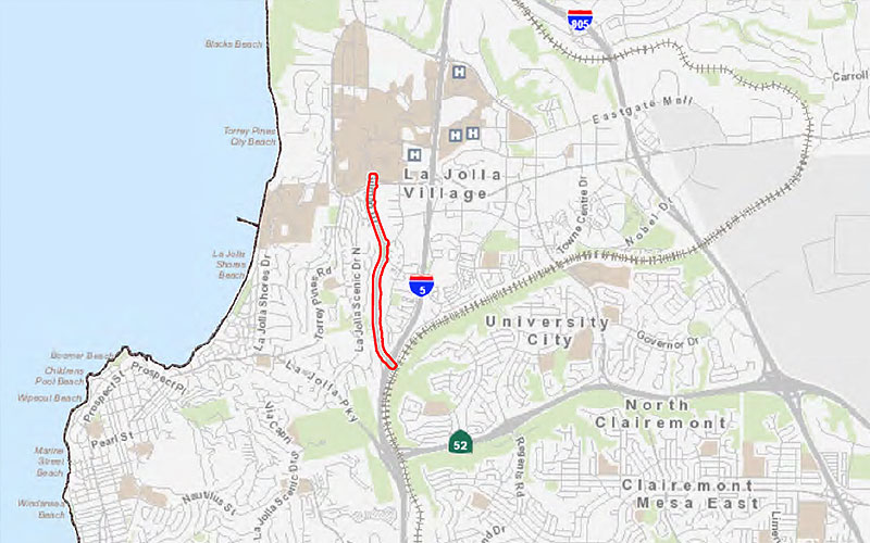
Prospect Street
From Ivanhoe Avenue to Draper Avenue
Project Status: Construction
La Jolla Boulevard
From Gravilla Street to Mesa Way
Project Status: Construction
Home Avenue
From Fairmount Avenue to Euclid Avenue
Project Status: Advertising
Park Boulevard Projects
Park Boulevard: Balboa Park
From Morley Field Drive to Presidents Way
Project Status: Construction (Estimated completion in early 2023)
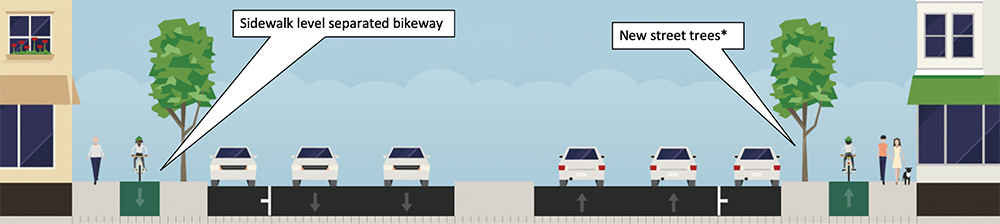
The Park Boulevard (Balboa Park) project provides transit improvements and a separated bikeway from Morley Field Drive to Presidents Way through Balboa Park following the Balboa Park Pipeline Replacement, Phase II. The City worked with Balboa Park institutions, MTS, neighboring communities, and the public to implement a high-priority project from the Bicycle Master Plan, make transit improvements and preserve some on-street parking near key destinations. The project connects to recently completed separated lanes in Uptown, University Heights, and Downtown and will connect with the Eastern Hillcrest Bikeways regional bikeway. The project will help the City with our Climate Action Plan and Vision Zero goals. The City is also committed to improving accessibility and mobility around the park and will continue to work with institutions to develop additional improvements supporting the park for residents and visitors.
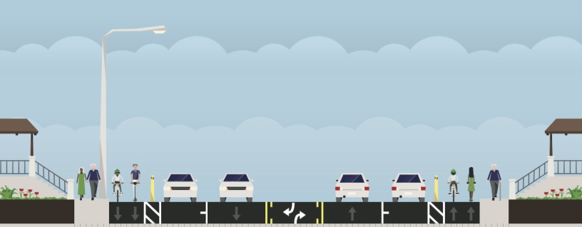
- Map of project with transit lanes (red) and on-street parking locations (blue). A separated bikeway is continuous throughout.
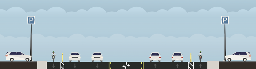
 Proposed cross section with separated bikeway, bus lane, and general travel lane
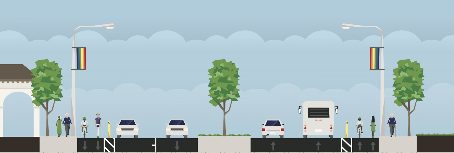 Proposed cross section near the World Beat Center and Centro Cultural de la Raza
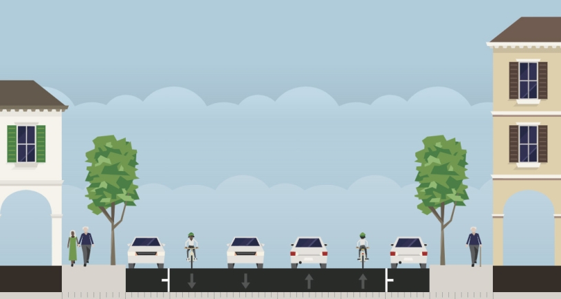
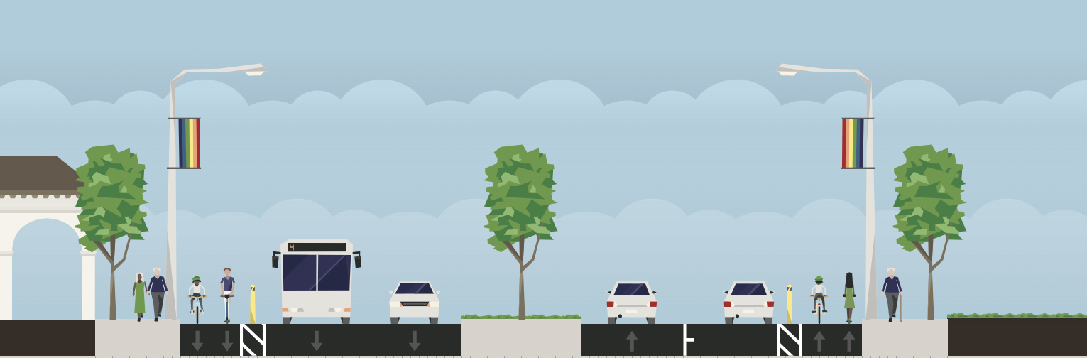 Proposed cross section near Rose Garden
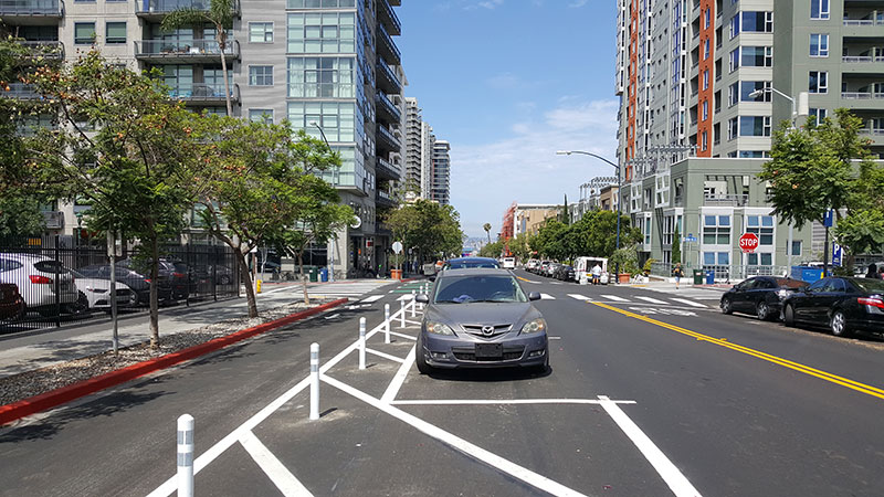
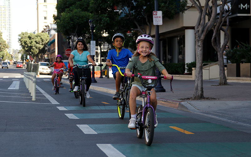
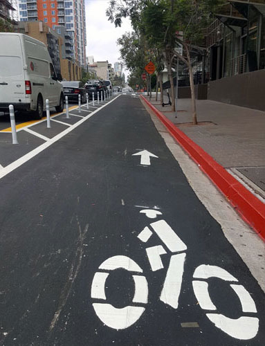
Park Boulevard
From Adams Avenue to University Avenue
Project Status: Open to Public
The Park Boulevard project provides separated bikeways from Adams Avenue to University Avenue with Slurry 2122. This segment is an identified high-priority project from the Bicycle Master Plan and connects to other regional bikeway improvements, including the Georgia-Meade, Howard Ave, and Eastern Hillcrest bikeways.
![]() Park Blvd Striping, Signing and Electrical Improvement Plan
Park Blvd Striping, Signing and Electrical Improvement Plan
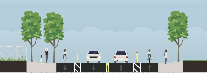
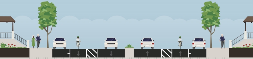
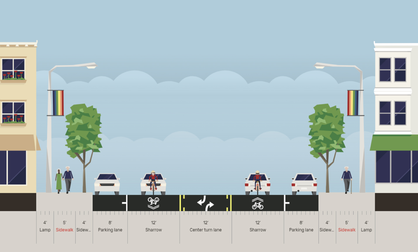 Existing Cross Section Adams Ave to Meade Ave
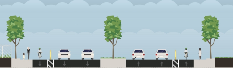
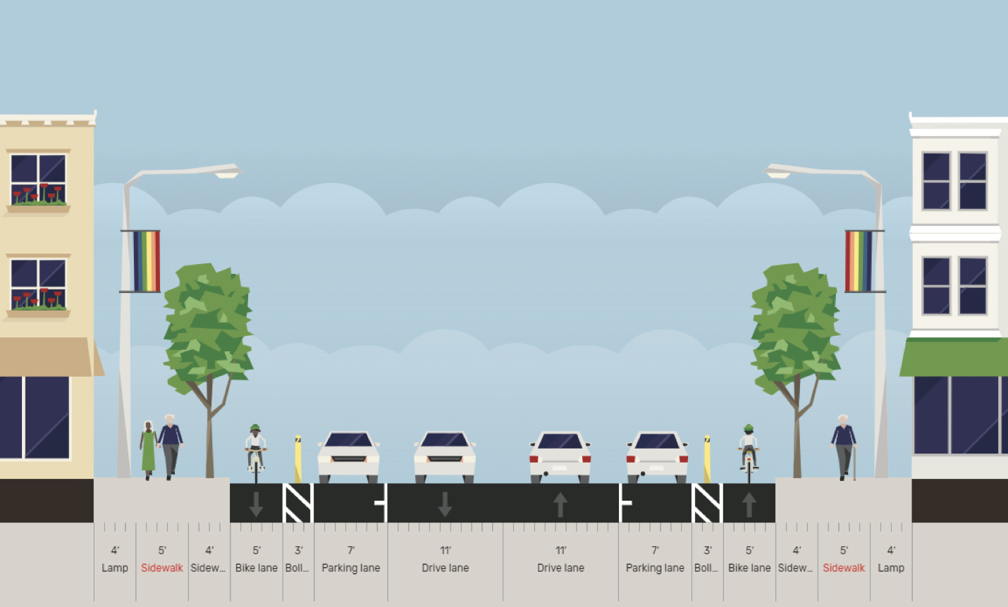 Sample Cross Section Adams Avenue to Meade Avenue
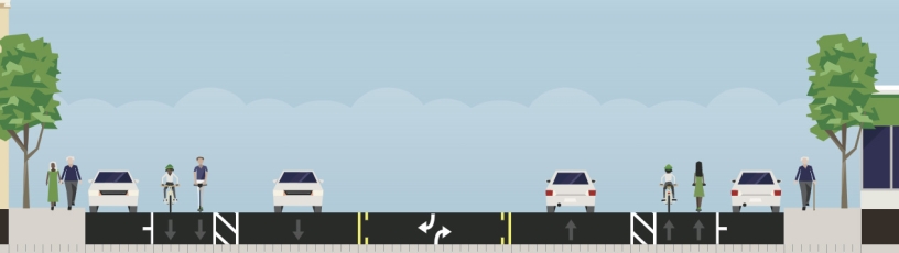
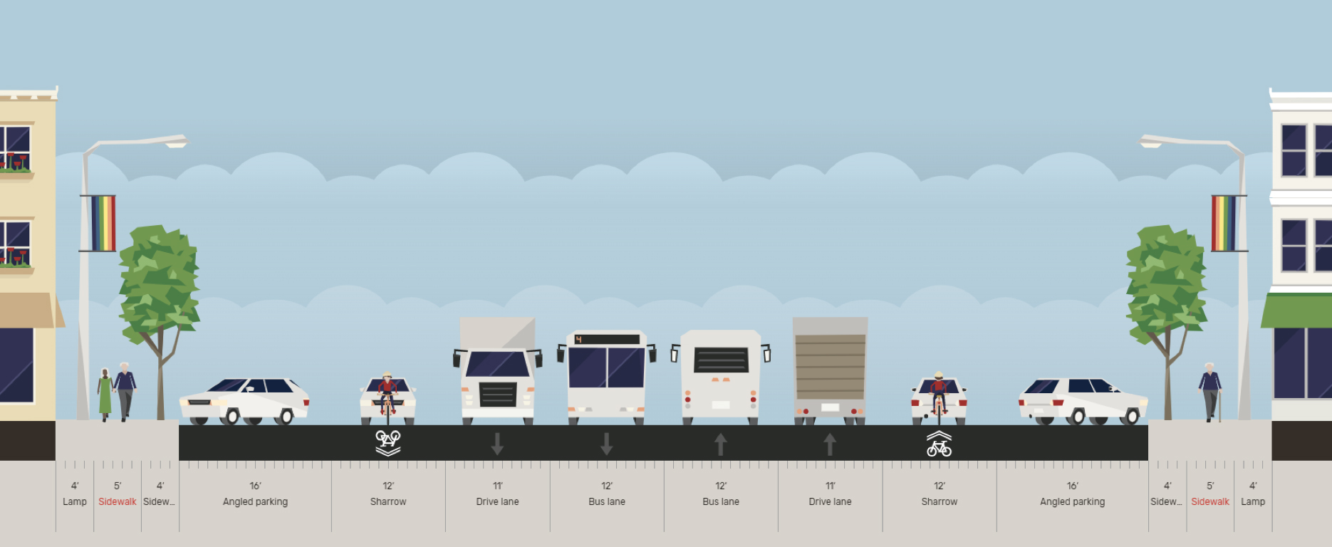 Existing Cross Section at Centre Street
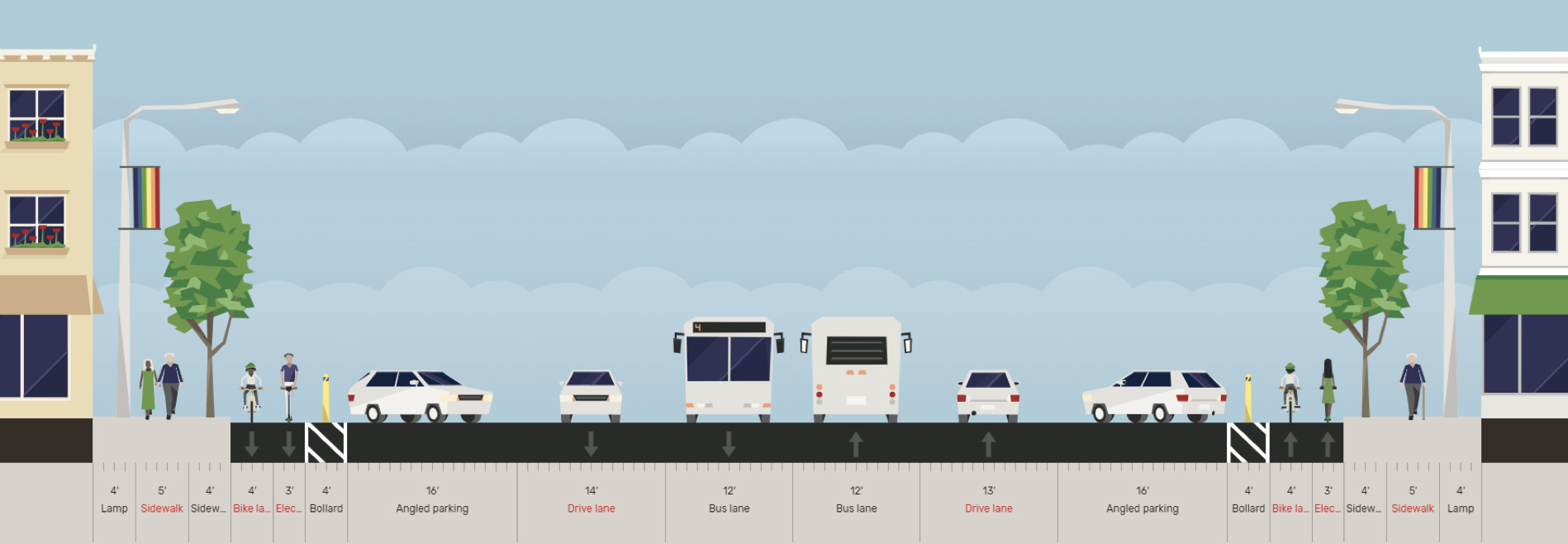 Sample Cross Section at Centre Street
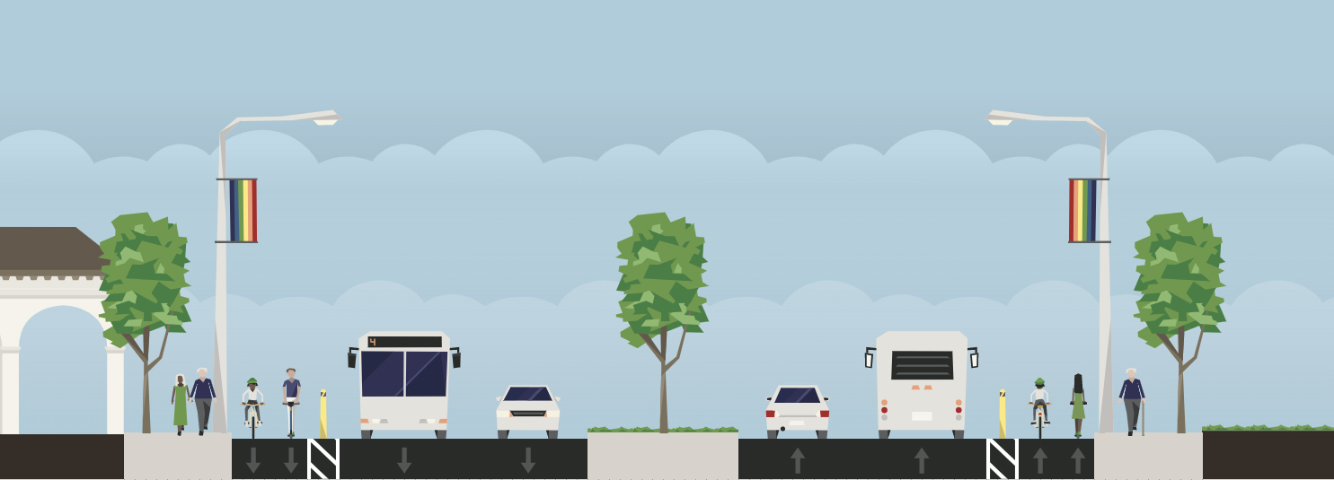
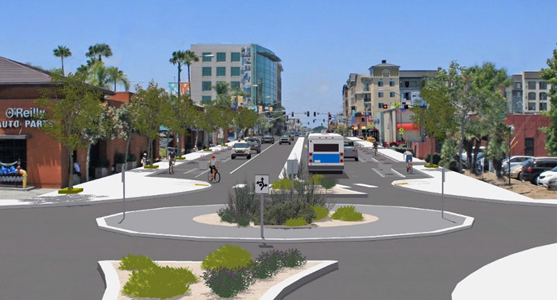
University Avenue Complete Street
Project Status: Construction
The University Avenue Complete Street project includes three new roundabouts, Class II bike lanes and widened sidewalks at University Avenue between Euclid and Fairmont avenues. This will improve safety for all modes of travel in the City Heights community. Roundabouts help reduce vehicle speeds and congestion and help people crossing the street stay visible with raised medians. This project supports the City’s Vision Zero goal of zero traffic-related fatalities or severe injuries by 2025 and is expected to be completed by 2024.
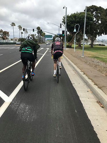
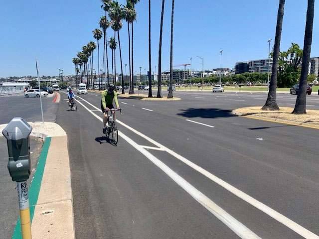
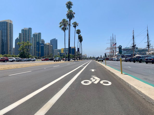
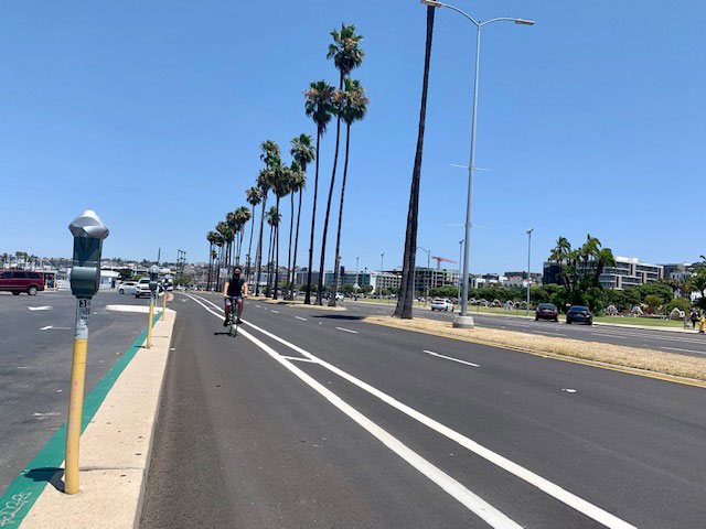
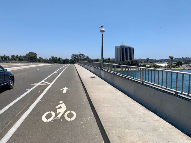
North Harbor Drive
Project Status: Open to Public
In Downtown, the entire length of North Harbor Drive now has expanded buffered bike lanes and green crossing markings at conflict points. Completed in May 2020, this project runs approximately two miles from North Harbor Drive at Nimitz Boulevard to Ash Street. These lanes are great for more experienced riders as an alternative to the nearby Embarcadero path.
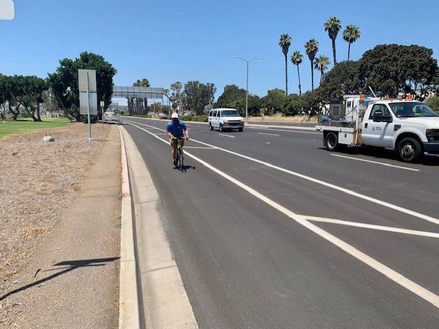
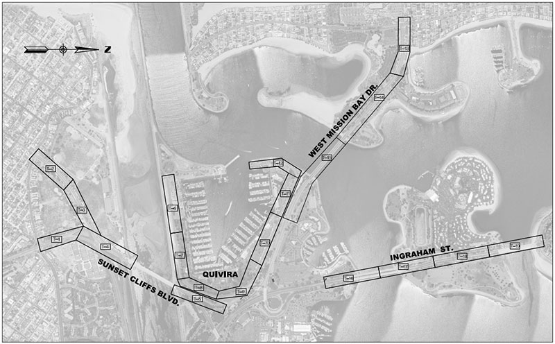
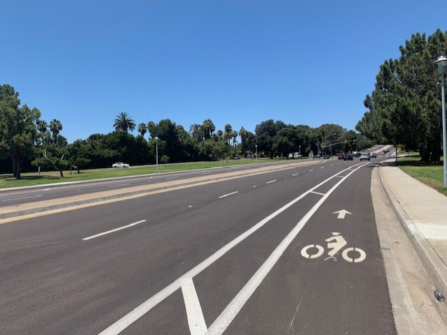
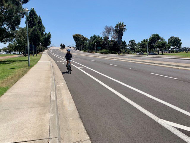
Mission Bay Roads Resurfacing
Project Status: Open to Public
The Mission Bay street resurfacing project, completed in May 2020, brought about 5 miles of buffered and standard (Class II) bike lanes to the Ocean Beach, Point Loma and Pacific Beach communities. New bike lanes were installed on West and East Mission Bay Drive, Nimitz Boulevard, Ingraham Street, Quivira Road and Old Sea World Drive. East Mission Bay Drive is especially popular for riders as it connects northern communities like Pacific Beach all the way to Point Loma and goes around Mission Bay Park.
Market Street Complete Street
Project Status: Award/Construction
The Market Street Complete Street project will bring more than two miles of Class IV protected bike lanes, on-street Class II bike lanes, wider sidewalks, medians and street trees to the Encanto neighborhood. This project stretches from 47th Street to Euclid Avenue and is expected to be completed by 2023. In addition, this project will include street resurfacing, curb extensions, curb ramps, street lights and traffic signal modifications to make biking and walking around this popular Encanto corridor safer and easier.
Downtown Mobility Plan
Project Status: Construction
In Downtown, Sixth Avenue and Beech Street are being converted to two-way Class IV protected bike lanes. Additionally, the J Street protected bike lane will be extended to 16th Street and Park Boulevard, and C Street will receive protected bike lanes as part of the landmark Downtown Mobility Plan. The current phase of the project is approximately two miles in length and is expected to be complete by fall 2020. Learn more about how the Downtown Mobility Plan will transform San Diego's urban transportation network, making biking and walking more safe and accessible.
Coastal Rail Trail
Project Status: Final Design
Approximately 2 miles long, the Coastal Rail Trail will stretch from UC San Diego to the Interstate 5 intersection near La Jolla Colony Drive, connecting to the Rose Canyon Bicycle Path via Gilman Drive. This project will include one-way Class IV protected bikeways along both directions of Gilman Drive, replacing an existing Class II bike lane. The project is currently expected to be completed by 2023 and will serve the Pacific Beach, University City and La Jolla neighborhoods. The project will also include a continuous sidewalk along the west side of Gilman Drive, street lighting, accessibility and traffic signal improvements. Learn more about the Coastal Rail Trail.